


THE BIOGEOGRAPHIC REGIONS OF COLOMBIA
ANDEAN REGION
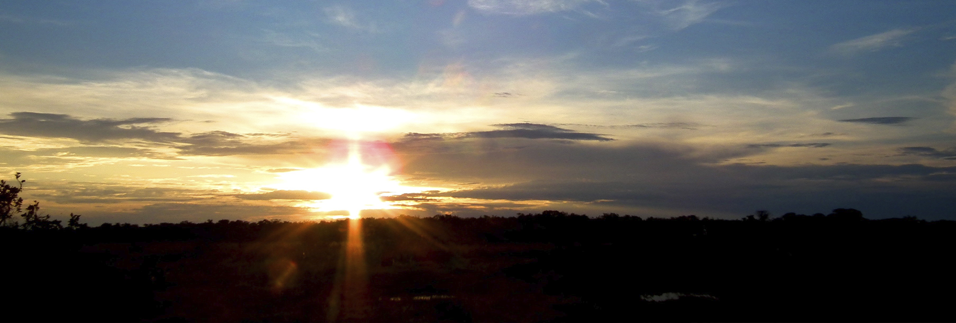
The Andean region is one of six natural regions in Colombia. It is located in the center of the country, limited by the Caribbean region on the north, by Venezuela on the northwest, by the Orinoquia region on the east, by the Amazon on the southeast, by Ecuador on the south, and by the Pacific region on the west. The Andean region is split in a SW-NE direction by three northern branches of the Andes: The Eastern, Central and Western mountain ranges. These mountain ranges provide numerous valleys, canyons, plateaus and a fluvial system conformed mainly by the Cauca and Magdalena rivers. The region has a population of 35 million people (2018), making it the most populated and economically active area in the country.
This region owns its name to the Andes mountain range, which in the north part of South America, specifically at El Nudo de los Pastos and the Colombian massif, it divides into three mountain ranges called the Eastern, Central and Western mountain ranges. The Central mountain range is separated from the Western mountain range by an average distance of 400 mts., due to a geological fault caused by the southern Patia River and the northern Cauca River. The Eastern mountain range gradually separates towards the east, creating the basin of the most important river in Colombia, the Magdalena River. This mountain range extends towards the northeast and it reaches its highest elevation at 5000 mts at the Sierra Nevada del Cocuy. An arm, called La Serranía del Perijá, is detached towards the north and it gradually reduces its elevation until it reaches the Caribbean Sea at Punta Gallinas on, which is located on the Guajira peninsula at the northern tip of Colombia. In Perijá, the Sierra Nevada of Santa Marta approaches, creating a valley ploughed by the Cesar River.
")
The Andean region holds the majority of water resources in the country, as well as the most agricultural productive fields. The exploitation of oil, emeralds, salt and other minerals is obtained on its subfloor. The most populated cities in the nation: Bogota, Medellin and Cali, are located in this region, as well as Bucaramanga, an important center of industrial development, highlighted by its footwear and jewelry industry. Cucuta is a city bordering Venezuela and Barrancabermeja is considered the crude oil city since it has the largest refinery in the country. Pereira, Manizales and Armenia are the main cities from the Coffee Belt region; Neiva, located in the department of Huila, connects the center with the south of the country and Pasto on the southwestern extreme of the country, connects Colombia with Ecuador and the rest of South America. In the Andean region, 80% of the national coffee crops are located, mainly distributed through the Coffee Belt (Caldas, Risaralda, Quindío, Antioquia, Valle, Nariño, Huila y Tolima).

The Andean region provides numerous architectural colonial communities, archeological centers of global importance and places where it is possible to practice high-risk sports. Here, there are all kinds of climates and landscapes, abundance in rich natural resources and a wide agricultural frontier which, with coffee as one of the main resources, has woven the economic and cultural history of the country. The Coffee Belt is sowed by undulated valleys and beautiful haciendas. The environmental conditions of this area are exceptional; the soil, light, temperature and humidity allow the flowerings to be permanently viewed and the polychrome of its petals decorate the housings as a gift from nature to the industriousness of the people. The housings around the Coffee Belt are grounded in the landscapes and the crops. Wood and bamboo are the main raw materials used to build these places where families have lived through generations and where cooperation is an attribute. The houses are spiritual, filled with colors and charm.
Here, the weather is calm, and generally warm and mild. In the Andean region, there are rainfalls throughout the whole year. Even the driest month has can have heavy rain. The climate is classified as Cfa by the Köppen-Geiger system. In the Andes, the annual medium temperature is 17.3 °C and the precipitation averages 994 mm. The lowest precipitation happens in August with an average of 29mm, while the highest occurs during the month of March with an average of 150mm. It has an average temperature of 24.0 °C, being January the hottest month of the year and July the coldest month with an average temperature of 11.1 °C. Between the driest and most humid months, the difference in precipitations is 121 mm. The medium temperatures varies at 12.9 °C throughout the whole year.
CARIBBEAN REGION OR ATLANTIC COAST
The Caribbean region of Colombia is the most northerly continental and marine natural region of the country. It is located on the north of Colombia. The region is limited by the Caribbean Sea on the north, where it gets its name from, by Venezuela on the east, by the Andean region on the south and by the Pacific region on the west. Its main urban cities are Barranquilla, Cartagena de Indias, Soledad, Santa Marta, Valledupar, Monteria, Sincelejo, Riohacha and Apartadó. In 2005, its population reached 9.506.220.
Physically, the Caribbean region is composed by the continental plains of the Caribbean. These plains are located at the north of the Andes and reside on the Sierra Nevada of Santa Marta, where the Guajira peninsula originates. The region is dominated by the delta of the Magdalena river and it has smooth coastline starting from the gulf of Urabá, in a southwest – northeast direction, to the gulf of Coquibacoa. However, the highest peaks of Colombia can be found here in the Sierra Nevada of Santa Marta (The Colon and Bolivar peaks).
")
Although the Caribbean in Colombia is predominately flat, it is characterized by its ecological variety, where its ecosystems range from dry forests of La Guajira to humid jungles of the gulf of Urabá. The region is flanked by the Eastern mountain range, precisely on the Sierra of Perijá, which limits naturally with Venezuela. Apart from the continental territory, the Caribbean region has extensive territorial waters on the Caribbean Sea.
The people of the Caribbean are the result of a racial and cultural mixture of the indigenous populations that have been inhabiting the region for thousands of years. White Spaniards that arrived to the Caribbean in 1499, introduced the black race from slaves of many African tribes. Also, in the last third of the XIX century, immigrants from Palestine, Lebanon, Syria, as well as some Americans, Dutch, Italians, French, Germans, English, Cubans, Venezuelans and Jews arrived to the ports of Puerto Colombia, Santa Marta, Cartagena de Indias and Riohacha.
The industrial, commercial, financial, and transportation activities are highlighted in the Atlantic department. Bolivar is characterized as an industrial, harbor, agricultural, farming, mining and touristic department. It is worth stating the mineral exploitation such as coal in El Cerrejon and ferronickel in Cerromatoso in Montelibano, as well as natural gas. There is also exploitation of salt in Manaure and Galerazamba. The main crops of the region are plantain, cotton, banana, rice, coffee, cocoa, yucca, African palm oil and fruits. Livestock is also very importantly developed on the plains of the Cordoba, Magdalena, Bolivar, Sucre, Atlántico and Cesar departments. Beef livestock is implemented in the departments of Cordoba, Magdalena, Bolivar, Sucre, Atlántico and Cesar and goat breeding is done in La Guajira.
The weather of the Caribbean region is tropical, characterized by warm temperatures throughout the year, on average of 25 ºC. Throughout the months, temperatures tend to vary minimally. In summer the highest temperatures can rise up to 30 ºC and in winter temperatures can reach as low as 22º o 23º C. May is the warmest month of the year and January is the coldest. The weather in the Caribbean is very humid. The relative humidity percentages fluctuate from 77% to 82.5%. Humidity is less during the months of winter, although is still high. Rainfall, however, occurs mainly during the summer, especially between October and December, and decreases during the winter. The driest month is March, while the rainiest is October. The last factor to consider about the Caribbean weather is the hurricane season, which officially starts at the beginning of June and ends towards the end of November. The months with higher probabilities of hurricanes are September and October. However, out of all the Caribbean destinations, there is less chance that hurricanes impact the Lesser Antilles and the South American coastlines.

PACIFIC REGION
The Pacific region is one of the six natural regions of Colombia. It encompasses the entire department of Choco, and the coastal zones of the departments of Valle del Cauca, Cauca and Nariño. It is located on the western area of the country; limited by Panama on the north, by the Caribbean region on the northeast, by the Western range on the east, which separates it from the Andean region, by Ecuador on the south and by the Pacific Ocean on the west, where the region gets its name from. It is part of the biogeographical area of Chocó and its divided into two large zones framed by the Corrientes cape. The main cities are Buenaventura, Tumaco and Quibdó.


It is a region with an immense ecological, hydrographical, mineral and forestry wealth where many natural parks are loacated. The region is also considered to be one of the most biodiverse and rainy places on earth, with precipitations of around 4000 mm per year, according to the Ministry of Mines and Energy in Colombia. It is also the main land of Afro-Colombian culture and numerous Indo-American tribes, which were denominated as “chocoes” by the Spaniards during the Conquest. However, such terminology includes linguistic families of different origins. The coastline places Colombia in front of the largest ocean of the world that provides an international meeting point which is vital for its development.
The Pacific region is mainly inhabited by Colombians that descended from Africans. These people have preserved their cultural roots, reflected in their dances. Likewise, some indigenous groups inhabit this region, such as the Emberas (from Chocó) and the Guambianos (from Cauca). The music from the pacific region reflects a coalition between Indigenous, Spanish, and African rhythms that converged during the Colonial times.
The economy of the Pacific region is based on industrial fishing, mariculture (growth of marine organisms for food products), timber extraction for national and international markets, industrial mining of gold and platinum, livestock and agriculture (mainly the crop industrialization of African palm tree, banana and plantain).
In the biogeographic area of Chocó there is a clear difference in the patterns of rainfall distribution. The main concentration of rain is recorded between May and November. The distinctive weather of the Colombian Pacific Region holds three characteristics which define it as tropical, with high temperatures (but not classified as too high), where humidity and precipitation predominate.
According to this last characteristic, the weather in the lowlands of the Pacific is very humid, with precipitations ranging from 3000 to 7000 mm, and precipitations surpassing 7000 mm towards the center of the region. Such situation happens on three out of the four departments of the region: Cauca, Valle del Cauca and Chocó.
AMAZONIA
The Amazon region of Colombia or Amazonia is one of the six natural regions of Colombia. It is located in the south of the country limiting on the north with the Andean and Orinoquia regions, on the east with Venezuela, on the southeast with Brazil, on the south with Peru, and on the southwest with Ecuador. It encompasses about 40% of the Colombian territory and it is the least populated region in the country. It is part of the Amazonian Jungle, a great South American region, which is the largest forest area in the world shared by Venezuela, Brazil, Colombia, Ecuador, Peru, Guyana, Surinam and Bolivia. As a result, the Amazon is the most forestry region that covers a surface of 483,119 km. The main cities of the region according to their populations are Florencia (121.898 p), San José del Guaviare (34.863 p), San Vicente del Caguán (31.011 p), Puerto Asís (27.609 p), Mocoa (25.753 p), and Leticia (23.811 p).
The Amazon is dedicated to the following economic activities: fishing, mining, livestock and timber extraction. Most of the economic activities done in this region are not in harmony with the landscape nor their native people. The complexity of the hydrographic basins of the region do not allow the construction of paved roads, not only due to its mass humidity but also because of fear of a negative impact on the environment. This is why the main access to the region is by airplane. Florencia and Mocoa are the only cities linked by land to the rest of the country. In the rest of the region, waterways are the main way of commuting.
The geographical location of the Colombian Amazons is on the Equatorial Zone covering both hemispheres and having a vertical incidence of the solar radiation throughout the entire year. This stimulates the zone under higher solar warming, providing a potential reception for solar energy which is intercepted by local convective systems that are associated with the precipitation system, biomes, zone-biomes, oro-biomes and primarily to the systems of intertropical atmospheric circulation.
According to the records of the meteorology stations of the IDEAM, the Colombian Amazon has a unimodal rainfall system, with a multiannual medium precipitation of 3307 mm, presenting the lowest values during the months of December-January, and the highest during May-June. In Leticia the multiannual medium precipitation is of 3194 mm, with the lowest values during July-August and the highest values during January-March; the other cities report similar conditions among them, with lowest precipitations during the months of December-January and highest values during May-July; Mocoa presents the most multiannual medium precipitation of 4376 mm, having the lowest values in October-November and the highest values during May-June; San Jose de Guaviare presents the least multiannual medium precipitation of 2499 mm, with the lowest values during the months of December-January and the highest values during June-July.


The flora in the Amazon is blessed by nature. There are countless species such as edibles, oleaginous, medicinal and colorings, in the middle of the jungle. Out of the 100.000 vegetable species present in Latin America, about 30.000 are located in the Amazon. The different levels of humidity during the periods when rivers overflow, the quality of the soil, the winds and the rainfalls have provided the formation of diverse vegetation. Such vegetation can be divided into three types: firm land forests, swamp forests and Vega vegetation.
The medium temperature in the region is 25.3 °C, with a minimum average of 21.5 ºC and a maximum average of 30.2 ºC; the lowest temperatures take place during the months of June to August and the highest values are during the months of December to January. Only in Leticia there are changes in the maximum and medium temperatures, in which occur during the months of October-November.
LLANOS ORIENTALES
The Colombian plains are part of the territory located on the east side of the Eastern Andes, north of the Amazonian basin (the Guaviare river being the natural limit) and its limit on the eastern extremity of Colombia is given by the Orinoco river in the south and the Arauca river in the north.
This region is known as: The Orinoquia or the Llanos and 4 departments of Colombia are part of these plains: Arauca, Casanare, Meta and Vichada. It encompass 18% of the national territory with an extension of 285.437 km2.
Its elevation above sea level ranges between 50-300 m.a.s.l. and it has low fertility soils. On the south of the Meta River we can find well-drained pains, with some protruding rocks that belong to the shield of Guyana. On the north of the Meta River we can mainly find floodable plains, extensions of savannas that flood during winter seasons. On the border of the Andean mountain range we can find the foothills of the plains and the formation of the Serrania de la Macarena is found on the southwest. Such formation is particular for sharing elements from the Orinoquia, the Amazons and the Andes. In general, the dominant ecosystems are inter-tropical savannas and riparian forests.
For many years, the economy of the region has been primarily based on extensive livestock. Recently, the extraction of crude oil has grown in the area. Also, agriculture takes place on a lower degree and since 2002 large extensions of African palm tree have been developed. “The llaneros” (people from the Llanos) have their own culture, where men are dedicated to raise livestock (“llanero”, “vaquiano” or cowboy) and agriculture. They are usually seen barefoot with a hat and machete. On the other hand, women are dedicated to house chores. Their music always narrates legends and local stories rooted to the land and farming, which tell tales of their fathers and forefathers that colonized this region.
The weather ranges between 20 – 36ºC, with an annual medium temperature of 26ºC. The rain system of the region is seasonal, with a drought period going from December until March, a rainy period going from April until July, a small drought period during August (little summer), and another rainy season with a precipitation peak in October.